Trail number
Not applicable
Trail length
Variable
Elevation variance
Variable
Trail type
Single trail,fire trail and gravel road
Trail surface
Smooth dirt and rocks
Weather affected
Prone to be muddy after heavy rain
Trail condition sources
Nil
Trail features
Mining history, river views
Trail obstacles
Nil

Trail rating
Intermediate
Rating basis
Estimated
Night riding
No
Family Friendly
No.

Use Topographic Map For This Area
No GPX download
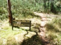
The pictures below track eastwards along Brocks Road. The second picture shows one of the walking tracks in the area where the signage clearly bans bikes.These trails are at the western end of the orange trail in the map above.
 |
 |
 |
|---|
You will wind up past Noonans Hut on the left and then on to the Tunnel Bend area. As you go up the road there are a number of little side tracks and walks which are well worth the effort.
 |
 |
 |
|---|
 |
 |
 |
|---|
 |
 |
 |
|---|
There are glorious views of the Howqua all the way.
 |
 |
 |
|---|
You will get to Tunnel Bend shown by the sign in the third picture. There are some short tracks off to the left. Tunnel Bend is where the gold miners diverted the river to work the alluvial gold deposits in the area. I had heard of this tunnel and was looking for a great big one like the Tunnel Point ride in Blackwood.
I almost missed this tunnel as its well hidden off to the right at the bottom of the stairs and is only the height of a person. Unlike the Blackwood one though you can walk through this tunnel and it's only a short distance. The tunnel entrance is shown below. If you do walk through the tunnel, you pop out on the opposite side of the car park to the track down.
 |
 |
 |
|---|
 |
 |
 |
|---|
A bit further up Brocks road there is a bridle trail off to the left which requires you to ford a deepish section of water which takes you to a trail below the road. Continuing on up Brocks Road you get some beautiful views of Buller and its ski slopes off to the left. With respect to the Bridle Trail, I think this is the same one as mentioned on the Felt Epix website which has a bit of singletrack along the river.
 |
 |
 |
|---|
 |
 |
 |
|---|
No video available for this trail.
 |
Parking is available at Sheepyard Flat. |
|---|---|
 |
Toilet facilities are available at Sheepyard Flat. |
 |
No drinking water is available. |
 |
No food or drinks are available in the immediate area. |
 |
No local information facilities are available. |