Trail number
The Erica MTB Park is split into a western and an eastern network of trails. The western network has 2 intermediate, 3 difficult and 1 extreme trail. The Tyers Rail Trail (easy) runs through the middle of this area. The eastern network has two intermediate and one difficult trail. The Walhalla Rail Trail (easy) runs through the middle of this area. Note further trails are being added all of the time and recently the Silvertop Spur was completed (not on MTB Park map yet.
Trail length
30 kilometres (over two park areas and excluding rail trails)
Elevation variance
120 metres (over full park area)
Trail type
Single trail, fire trail and gravel road
Trail surface
Coarse gravel, rocks and rock outcrops
Weather affected
Prone to be muddy after medium rain
Trail condition sources
Trail features
Berms, jumps, drop offs
Trail obstacles
Log obstacles, B-lines available


Trail rating
Easy, Intermediate, Difficult and Extreme
Rating basis
IMBA
Night riding
Yes
Family Friendly
Younger MTBers may be able to ride some of the intermediate trails as long as they have good skills.
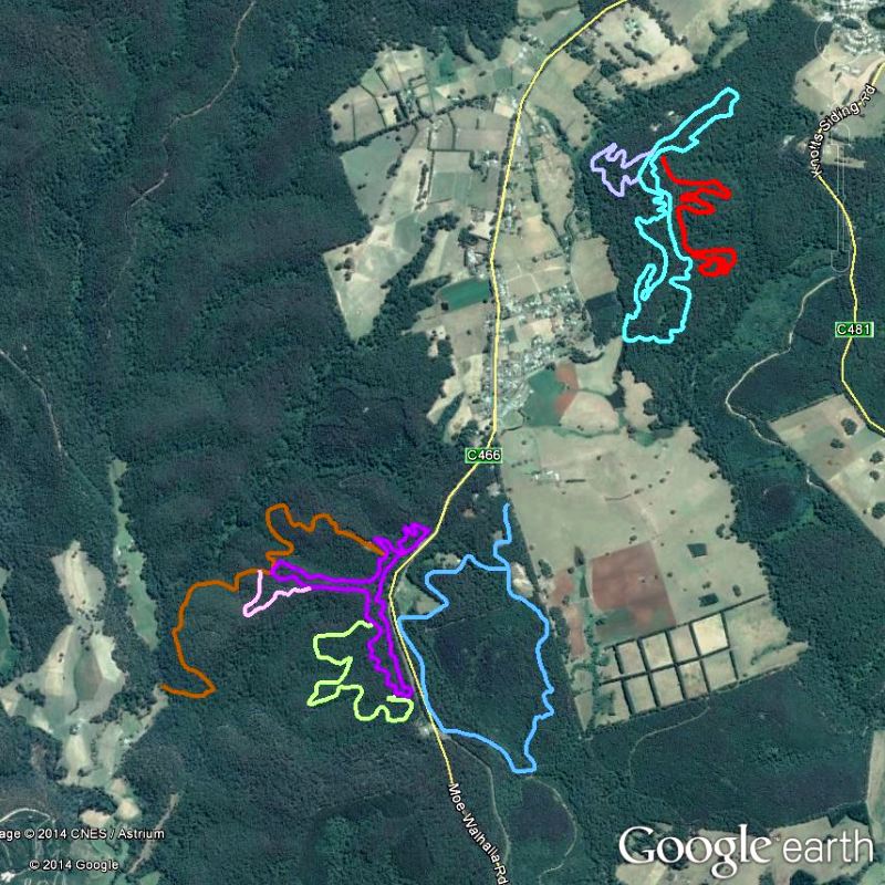
Click Image For Trail Map
No GPX download
The Erica MTB park has two distinct trail areas and is located between the Tyers Rail Trail and Walhalla Goldfields Rail Trail which provide further opportunities to explore the surrounding area. My thanks go to Neil Allen for the provision of the latest maps of the area and we will provide updates as they become available. Please support the development of these trails by using them and supporting the volunteer efforts being put in.
I have only ridden the SSS trail out of all of these trails so far as well as the adjoining rail trails. Unfortunately the camera was playing up on the day so I don't have pictures of this trail and this trail has now been deleted in any case
I have included a YouTube video below to give you a flavour of the trails and there are further pictures and details on the Erica MTB Park Facebook Page.
The EricaMTB channel has a number of videos of trails in the area so access it for further videos.
 |
Parking is available at the three trailheads. Click on the Google Earth image above to access the trail map which shows the main parking areas. |
|---|---|
 |
No toilet facilities are available. |
 |
No drinking water is available. |
 |
No food or drinks are available in the immediate area. |
 |
No local information facilities are available. |